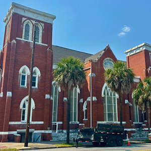
"EMERGING quality of life criteria like walkability, bikeability, and proximity to parks are all measurably greater in Savannah's historic districts than elsewhere in the city."
That’s a passage from “Beyond Tourism: Historic Preservation in the Economy and Life of Savannah and Chatham County,” a study commissioned by the Historic Savannah Foundation.
What the report calls “emerging quality of life criteria,” were regarded very differently up until around 50 years ago, before we began reconfiguring our built environment exclusively around the needs of automobiles.
Today’s “emerging criteria” are yesterday’s sensible, practical, common sense approaches to designing cities.
Still, an introduction to the study by Bea Wray of the Creative Coast stresses that active transportation options and dense, vibrant neighborhoods are desirable to an important demographic.
“Goldman Sachs reported that the 92 million Millennials makes this generation the biggest in history and they seek walkable, bikable and healthy communities,” she wrote.

The study’s authors compared walking and bicycling conditions in Savannah’s historic neighborhoods to the city as a whole, using Walk Score, a proprietary system that “analyzes hundreds of walking routes to nearby amenities for a given location” and Bike Score, which determines the bikeability of a location “by measuring bike infrastructure (lanes, trails, etc.), hills, destinations and road connectivity, and the number of bike commuters.”
The results of the comparison should not surprise anyone. Savannah’s overall Bike Score is 48, putting it in a range characterized as “somewhat bikeable” with “minimal bike infrastructure.”
Meanwhile, every historic district scored higher than the city average, with the Landmark District scoring over 90, making it a “biker’s paradise.”
Yet there is trouble in paradise that isn’t detected by Bike Score and Walk Score algorithms. For instance, the Lincoln Street bike lane is unusable north of Gaston Street, due to badly damaged pavement.
What’s more, it’s on the wrong side of the street, which encourages wrong-way cycling.
Other problems are not as immediately recognizable as Lincoln Street’s degraded surface and substandard design.
Martin Luther King Jr. Boulevard was once the western boundary of downtown Savannah. At least it seemed to me when I moved to Savannah in 1993.
Today there are many reasons to cross MLK, including the Joe Murray Rivers Jr. Intermodal Transit Center, expanded attractions at the Georgia State Railroad Museum, and new hotels and restaurants.
Despite this, the street is difficult, unpleasant and dangerous to people on foot or on bikes.
Members of my family recently stayed at the Embassy Suites Hotel on West Oglethorpe Avenue. After checking in, they set off to explore the Historic District. They walked to the corner of Oglethorpe and MLK, where they waited in the heat.
They continued waiting as the sun beat down. And then they waited some more.
Finally, a walk signal allowed them just seconds to dash across the street between drivers turning right onto MLK, some without even stopping at the red light.
They concluded it was easier and safer to retrieve the car from the hotel garage and drive across MLK to the closest available parking spot.
This wasn’t a traffic signal malfunction. The intersection was doing exactly what it was designed to do: move as many cars as possible as quickly as possible.
The unintended result? It incentivizes driving, thereby worsening congestion and increasing demand for parking.
Intersections like this are incompatible with a city seeking to “provide mobility options, and enhance the overall quality of life for residents, employees, and visitors alike.”
That’s one of the goals of Parking Matters, a collaborative effort between the CORE MPO, through the Chatham County-Savannah Metropolitan Planning Commission and the City of Savannah. Recommendations will be delivered at the end of this year.
Planning for the proposed “Arena and Historic West Boundary Canal District” must consider how to adapt streets, which were reconfigured last century to speed cars in and out of the city, to serve the needs of people who live in the city now and in the future.
The redevelopment of SCAD dormitories on Boundary Street, which will significantly increase their residential capacity, will require solutions for safe passage even sooner.
In “The Death and Life of Great American Cities,” Jane Jacobs describes, “the erosion of cities by automobiles” as a “kind of nibbling.”
Streets are widened, others are converted to one way, traffic signals are timed to maximize car throughput, and more space is claimed for storage of idle motor vehicles.
All this nibbling results in streets that chew up and spit out people who walk and ride bikes.
To preserve and increase quality of life, we must restore what’s been eaten away.