Snaking through coastal marshes and tidal estuaries, this palm-lined ribbon of asphalt is the only mainland access for 3,500 Tybee Islanders and thousands of summertime beachgoers. Though its picturesque, anyone driving US Highway 80 can see that the whole length has serious safety issues.
Notably, a passing lane abruptly becomes Fort Pulaski's turn lane. And each of the two bridges that bookend the roadway are two-lane, without shoulders. Merging onto these aging structures at high speeds often creates severe bottlenecks and driver confusion.
These problematic areas, along with others, are blamed for numerous accidents every year. Since 2009, six people have died on the Tybee Road with dozens more injured.
Although heavily used roads do experience occasional crashes, according to Georgia Department of Transportation (GDOT), "the crash rates on US 80 between the two bridges are consistently higher than the statewide average for similar types of roads." Around 50 percent higher.
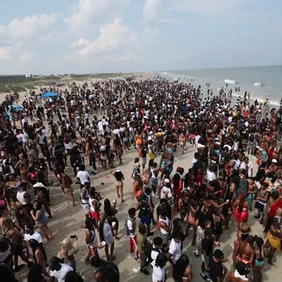
Being sole artery to the beach, most accidents on the Tybee Road do occur during the summer, and many are alcohol-related. Moreover, seasonal drivers visiting Tybee can be unfamiliar with roadway... quirks. This information actually reinforces the need for road improvements, rather than provide culprits for elevated accident data (and the excuse to do nothing).
Knowing what kind of drivers most likely use the road, especially in the summer, Tybee Road should be free of confusing sections, high speeds and poor signage, which only serve to exacerbate a tenuous situation.
Echoing many locals' sentiments, Tybee City Councilman Paul Wolff simply calls the roadway "a real public safety concern" and "dangerous."
What further frightens Tybee residents and local officials is the double accident scenario: An accident on one of the narrow bridges stops traffic for hours and cuts off thousands from the mainland. It's happened before.
But, if another emergency — of any kind — occurs on Tybee during such a bridge closure, ambulance transportation by land off the island is literally impossible.
For first responders and the poor souls needing treatment, navigating Tybee Road's slim lanes and heavy seasonal traffic is difficult enough. Yet, potentially being stranded, unable to access a hospital, is a different kind of unnerving. The causeway and bridges have been in this structural configuration for multiple decades, however.
The Bull River Bridge was built in 1967; the Lazaretto Creek Bridge in 1960. So, why is it taking so long to remedy these obvious problems?
US Highway 80 — Tybee Road — isn't the responsibility of Tybee or Chatham County. It's under the jurisdiction of Georgia. Any locally -desired changes, even seemingly simple things like lane re-striping and improved signage, must be studied and approved by Georgia DOT.
It's the job of our local elected officials to make Tybee Road a priority in Atlanta, so, in turn, monies can be allocated for studies, design, permitting and construction.
Of course, Georgia really likes getting matching federal funds for road projects. But federal regulations — including separate permitting for environmental impact — complicate things even further. All that takes years to develop and coordinate across various government bodies.
Another issue, which possibly caused delay for US 80 improvements, was setting initial expectations too high. Throughout the '90s, as Tybee Road showed its age, "four-laning" the causeway and bridges was the myopic goal of many island residents and local officials.
In 1999, however, a GDOT study found the four-lane option would cost over $100 million, and those expenditures didn't match area demographics nor road use.
"It was overkill," Councilman Wolff says. "A lot of people on Tybee thought it was too much to ask for."
Today, costs of this "Cadillac Plan" are estimated at $125 million. GDOT has summarily dismissed the idea as too expensive and unnecessary, as it's currently not on their "long range program."
Funding aside, four-laning entails excessive environmental impact.
That permitting — state and federal — would likely take many years with an uncertain outcome. Unfortunately, during a more favorable political climate in Washington, D.C. as well as Atlanta, opportunities for reasonable improvements on the Tybee Road may have been missed in the early to mid-2000s.
In 2010, a decade after the 1999 study, the Coastal Regional Metropolitan Planning Organization (CORE MPO) began work on a comprehensive plan to make the Tybee Road safer and more pedestrian-friendly. The CORE MPO is the area governmental body which identifies, prioritizes, studies and seeks funding for local transportation projects.
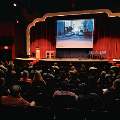
In December 2012, after two years of design and four public meetings, CORE MPO delivered its study — six possibilities and a recommendation. Widening to four lanes and a no-build alternative were also included as cost/impact comparisons.
The extensive "US 80 Bridges Replacement Study," along with a video, is available at the CORE MPO section of www.thempc.org.
Their recommended "Alternative 3" replaces both bridges, expands all lanes for bikes and pedestrians, raises the roadway in low spots and creates two new entrances at McQueens Trail and Fort Pulaski. The cost is $65 million.
"It could be 2018 or 2019 before construction begins if everything goes well," says Tommy Thomson, Executive Director of the Metropolitan Planing Commission (MPC).
It could take longer. The CORE MPO has set aside roughly $4 million for engineering and design studies to take place by 2016. GDOT has also "programmed" funding for 2016 to begin their own two-year "scoping" process.
"Beyond that point," Thomson says, "additional money has not been allocated."
The CORE MPO will be seeking federal and matching state funds for construction. "There is ... the ongoing issue of funding for roads and bridges not just locally but nationwide," notes Tybee's Mayor Jason Buelterman. "The problem is especially acute in Georgia."
As the US 80 Bridge Replacement project seeks money around 2017 and 2020, the DeRenne Corridor rebuild ($75 million), the Causton Bluff drawbridge ($40 million) and Jimmy DeLoach at Highway 80 improvements ($80 million), among others, will all be vying for government dollars.
Thomson admits that, considering these other projects, Tybee Road funding is "not impossible, but difficult."
Evidenced by the massive funding demanded by the Savannah River harbor deepening, fixing up a Georgia roadway leading to a small island community may be a low priority.
To boot, Tybee Road's carrying capacity is only exceeded for a few holiday weekends per year. About 90 percent of the time, it handles traffic well, according to the CORE MPO (safety issues aside).
Thankfully, other funding options are on the table. Chatham County could put the Tybee Road/US 80 improvements on its list for SPLOST money. Using this local option would bypass the need for matching federal funds, regulations and permitting.
Only state regulations would apply, which could fast-track Tybee Road improvements by up to a year, Thomson says.
It's also possible to split up the project into 3-5 sections and not ask for all the state/federal money at once. There's a greater likelihood of landing matching funds for smaller projects.
Thomson also points out that doing improvements piecemeal would be less expensive in total; however, the construction window could be 4-6 years, rather than two years. That would have to be weighed by citizens of Tybee and elected officials.
Further, Bull River Bridge scores a 61 on a recent GDOT bridge assessment. A 50 score calls for immediate action to replace or rebuild. Lazaretto Creek Bridge scored a 41. Though public meetings with CORE MPO, Tybee Road could be sectioned and designated for priority.
Better signage and lane re-striping might be a reasonable initial package to aim for. Thomson offered that moving traffic merge-points further back, away from bridge entrances, would do wonders for safety.
In 2011, the Wave Ecology Study, sponsored by Chatham County, tasked stakeholders and officials to address the "waves" of traffic that Tybee experiences. The final report is at www.thempc.org.
The study group advocates for a lower speed limit on the Tybee Road and bridges. Another suggestion is sectioning off passing lanes, effectively eliminating merge points altogether.
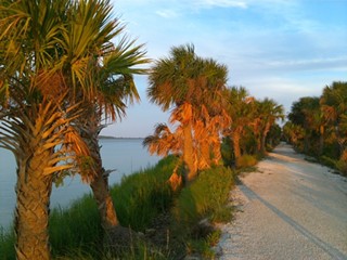
McQueens Trail, parallel to the drivable causeway, is a protective buffer against the tide. Under the jurisdiction of Chatham County, McQueens Trail is slated for $325,000 worth of improvements.
Making this strip of land more attractive to bicyclists could be worth every penny. Highway 80 is no place for cycling. An updated McQueens Trail would provide the necessary and safe bike/pedestrian thoroughfare.
From the mainland all the way to Fort Pulaski, bikes and pedestrians could be totally separated from auto traffic. For Tybee, with its tourism economy and finite parking, increasing bike access may be intriguing.

