It is utterly cliché to start an article with “It is a study in contrasts…” So I will spare you that, though if I weren’t so particular about avoiding clichés, it would be the most appropriate opener for this article on the Savannah River and my experience traveling down it for four days.
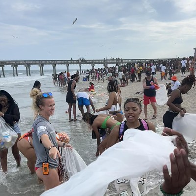
Last month I went on the Savannah Riverkeeper’s annual river trip. It starts in Augusta, where the river settles into the coastal plain with a voluptuous repose after tumbling from the Blue Ridge Mountain, and ends in Savannah, where the river empties into the Atlantic.
River Mile 200
The Savannah River flowing through downtown Augusta has a different personality than the one we know running past River Street toward the wide-open sea. Looking down from a pier in Augusta’s downtown marina, I can see seaweed undulating and small fish darting between pilings.
A Bull River Cruises’ 45-foot pontoon boat, owned and captained by Mike Neal, is being loaded with gear for a four-day expedition that will take several dozen passengers and crew 200 miles downriver tracing the Savannah’s rich history and looking at what lies ahead for this great river.
The water reflects the color of the sky, which is a late September blue, cold and distant in the morning, but in the afternoon it’s plumbago-blue and the golden light is the sort favored by the butterflies -- monarchs, cloudless sulphurs. Once past Augusta, the land on either side of the river turns wild -- sycamores and cypress vying for space on the banks and black willows growing on the sandbars below.
“Fifty years ago there weren’t trees on those sandbars. The river used to wash over them like the ocean,” says Harold, a wonderful old fellow from Trenton, S.C., who was my seatmate for much of the trip. He grew up in the country of the upper Savannah River basin learning first to swim in the river’s tributaries, then teaching his own son to fish its waters. Now he is taking his long-awaited journey “all the way down the river,” to Savannah.
Dr. Frank Carl, founder and chairman of the Savannah Riverkeepers -- often royally referred to as “The Riverkeeper” -- explains how the dams and the cuts in the river have changed its alluvial flow. The Army Corps of Engineers built dams to control flooding in the basin, then cut off 49 meanders in the river to make the waterway straighter for commercial barge transport.
Barge traffic has long been a thing of the past, replaced by rail and highway, and now the Corps is considering putting the meanders back into the river.
“The faster flow from the Corps’ straightening creates higher erosion and more silt,” says Dr. Carl. In recent years it has become increasingly clear that marshes and meanders play an important part in the overall health of the ecosystem. They act as natural filters, removing silt and pollutants from the water.
“Egret on your left!” calls out Karen Grainey, onboard naturalist and board member of the Savannah Riverkeepers. The most ubiquitous bird along the river is the Great White Egret, which flies long and low, occasionally swooping across our bow, all wing and neck.
Grainey sets into a story about the near-extinction of the great egret while passengers train their binoculars on the bird, now up to its black stick kneecaps on the muddy shore. The Hat Era of the late 1800’s measured a woman’s status by the length of her plume and it was the long dainty mating feathers of the great egret that were high fashion of the day. Fortune seeking “plume hunters” were getting rich and slaughtering the bird into near oblivion when Harriet Hemingway, a blue blood with a conscience, influenced legislation to protect the birds.
And so it is today that the great egret with its long yellow bill is the predominant face of the Savannah.
Environmentalists haven’t shared Ms. Hemingway’s same success when it comes to protecting the river from the exploits of industries. As we pass Olin Corporation, Dr. Carl points out the water churning from the chlorine manufacturer’s outtake and explains that the mercury levels in Olin’s outfall channel are three times above background levels.
The water is a sickly greenish brown before swirling into the current and flowing under our boat carrying us downstream.
River Mile 162
After several hours on the water a lull sets in, bringing with it a sense of timelessness. Wispy brushstroke clouds are overhead and dragonflies swoop under the boat’s canopy and out the other side.
I stare off, imagining Native Americans in their piraguas, paddling down the same stretch of river bordered by low banks of birch and switchgrass and every so often rising to a high bank. We pass one such bank, Shell Bluff, home of fossils, shells and 40-million year-old whale bones that tell the geological story of the retreating Atlantic Ocean.
The story of human movement is evident along the river too. The Topper Site further down the river created an international ruckus in the archeological world when a professor from the University of South Carolina uncovered artifacts from 50,000 years ago, the earliest evidence of human habitation on the continent.
The first night we camp along a particularly beautiful bend of the river, pitching tents on an expansive well-clipped lawn that surrounds a large log cabin owned by a Savannah Riverkeeper board member. We eat biscuits and green beans on the wide plank porch, the inky night river below, the double cooling towers of Georgia Power’s Plant Vogtle above, the reactor’s steam white in the moonlight.
This remote spot marks the beginning of the nuclear age and the eventualities that accompany it. Across the river in South Carolina is the Department of Energy’s old nuke plant, Savannah River Site (SRS). According to Dr. Carl, Plant Vogtle and SRS “have made the lower Savannah River the most tritium-contaminated environment in the U.S. ”
“What is tritium?” asks a wide-eyed lady from Atlanta. Carl explains that it’s a radioactive hydrogen molecule that “becomes part of the water molecule,” and like the heavy metals and chemicals from manufacturing, it is impossible to filter out.
The Atlanta lady swallows her horror with a swig of Crystal Springs bottled water.
The Savannah has long supplied drinking water not only to Augusta and Savannah, but also to Hilton Head, Beaufort and many of the smaller municipalities in the ten thousand square mile jalapeño-shaped river basin. And as salt water intrudes into the aquifers near the coast, the freshwater of the Savannah becomes an ever more important source of water, contaminated or not.
River Mile 151
Morning steam rises from the sunlit surface waters in slow wisps. A Georgia Public Broadcasting crew that is along on the trip is shooting footage of the river’s breath through light dappled leaves.
Save for an occasional abandoned plywood houseboat or a rusted hull of a half submerged barge, our expedition doesn’t pass a soul. Every quarter of a mile, for the next thirty on the South Carolina side, we pass federal warning signs saying “No Trespassing. By Order of the United States Department of Energy.”
There aren’t any visible buildings from the river, no reactors like Plant Vogtle looming from the river banks -- only high fences across the three tributaries that stream from SRS into the river.
A quiet environmental scientist from the DOE is onboard. He tells me he has come on the river trip because he’s interested in what the Savannah Riverkeepers are saying about SRS. He describes the super-sludge uranium in the underground steel tanks as having the consistency of peanut butter and being almost impossible to fully remove.
I ask him how the drinking water standards for radionuclides like tritium were established, he shrugs his shoulders and calls the EPA limits a “wild-ass guess.”
Then Dr. Carl gets out his oxygen testing kit. He is about to demonstrate a test that measures the oxygen levels in the river water. The higher the oxygen, the healthier the water.
Water can hold up to 15 parts per million (ppm) of oxygen and on this beautiful October day the Savannah River measures a dismal 4.4 ppm. Carl says that the oxygen levels generally decrease as you go downstream and that “the dissolved oxygen is too low in the Savannah Harbor to support fish life.”
The Corps of Engineers’ plan for dredging the river deeper to accommodate the mega-ships will almost certainly seal the fate of the lower Savannah. The water will be nearly devoid of oxygen, and for the purpose of supporting life it will be all but dead.
River Mile 104
“Who cooks for you? Cooks for you? Hoo Hoo,” the barn owl calls into the dark night where we camp the second night at a clearing called Cohen’s bluff.
Rusted furniture and homemade benches are arranged like a kitchen and a living room, the fire pit where a coffee table would be. Someone describes the stars as blazing balls here, not the mere twinkles they’re used to.
Unlike the first two days, on our third we pass a handful of other river vessels, mostly small fishing boats and one shiny houseboat complete with a white picket fence and a dog on the front astro turf lawn. We see more alligators too.
“The temperature of the egg dictates the sex of a gator,” Karen explains as we glide by a 7-footer sunning itself on the mud bank. “Below 86 degrees and the gator will hatch a female.” Someone makes a joke about a hot-blooded male, and the others laugh.
The women watch an anhinga and listen to Karen’s enthusiastic trill, “he’s a swimming bird, built for diving with dense bones and a long thin neck. He can go 20 feet deep.”
Karen’s breadth of knowledge on all things natural makes her the river’s greatest reference. It’s an odd luxury to float down a waterway while being entertained with lovely descriptions of such things like why Spanish moss is called what it is when it is neither Spanish nor moss.
“Some of the first colonizers named it after what it looks to be, an old Spaniard’s beard.” She explains that it is not parasitic, but an air plant, and “in April you can see its greenish-blue blossoms, little pea pods carried on the wind to a branch.”
There are few public access points to the river, and the couple that there are tend to be deep in the backcountry of Georgia and South Carolina.
African American fishermen walk well-worn paths down the low-banks of places like Little Hell’s Landing, where a natural spring burbles in the sun and locals share a can of Budweiser on a Saturday afternoon in their car.
River Mile 49
By the afternoon of the third day on the river, we are sun-warmed, and have pulled our longest day -- 59 miles on the river. We are all looking forward to the prospect of a shower and bed at the New Ebenezer Lutheran Retreat, a short walk up a hill from the river bank.
The church on the tree-shaded grounds is the oldest public building in Georgia and was a haven for persecuted Austrian Lutherans of the 1700s. There is an aura of history and quiet here. We talk in whispers, planning our early morning paddle down Ebenezer Creek.
Karen has been paddling Ebenezer Creek for years as a guide for Wilderness Southeast. As we set off in the still morning twilight, she explains that the blackwater of the creek is the result of the cypress gum leaves steeping in the slow moving water, much like a pot of tea.
The water looks more like Starbucks bold roast than Earl Grey to me, but twenty minutes into the paddle and I stop pining for my morning caffeine. Long gold streams of sunlight hit the ancient cypress forest at an angle, a half-black and half-gold world, the light of an old master’s painting. It is known as an “enchanting” place in paddling circles, and its otherworldliness belies its Rincon location.
During the high water of spring, Karen says that it’s possible to paddle back into the tupelo forest, into the blackest of waters where 1,000-year-old cypress trees loom and the wild greenfly orchid grows.
I make a promise to myself that I will come back to this place.
River Mile 42
Tucked in a river bend, Plant Kraft rises from the bank like a giant erector set. The outtake of wastewater here creates it’s own current with eddies of brown-green water below a frothy film.
Kraft is an old-style coal-fired electric producer, but it’s representative of the many industries lining the river once we pass under the I-95 bridge. This Southern Company plant draws 267 million gallons of water from the river a day, returning a small percentage laden with heavy metals and toxins.
Five miles downstream, the city of Savannah draws the same water back in for drinking water.
“The whole world has changed in fifty years, not just the river,” says Harold as we round the corner to the Georgia Ports Authority.
To our left is the Savannah National Wildlife Refuge; to our right is the “fastest growing port in the country,” says Captain Mike.
Karen’s last story of the river is still unfolding: “The refuge and the port have different goals. The Port’s is to make money, the refuge is to protect endangered species.”
The issue of harbor deepening has brought the two into conflict because the deepening will result in saltwater intrusion into delicate freshwater marshland.
It’s a complex issue, and Karen shrugs her shoulders.
“The two will just have to figure out how to get along,” she says.
River Mile 14
Captain Mike sides our boat up to the public dock on River Street. We disembark; standing on the concrete quay longer than necessary, taking last looks at the river as we wind up conversations.
Slowly we start to thin one by one, flowing into the bustle of the crowd.
Stacey Kronquest is a local freelance writer. To comment, e-mail us at
Savannah Riverkeeper’s 2007 River Trips
2007 Savannah River Expedition
A four-day cruise starting from Augusta’s waterfront and meandering 196 miles downriver to the docks of Savannah’s River Street. Scheduled for late September.
Savannah Riverkeeper Discovery Cruises
Discover the diversity of the river’s shoreline departing from the Savannah National Wildlife Refuge and wandering through the harbor and downtown Savannah, then coasting through the estuaries where the river meets the ocean. Daylong outings run from March through November.
For schedule and rate information, contact Maria at the Savannah Riverkeeper, 912-228-5471 or check out
www.savannahriverkeeper.org
Savannah River Trivia
• Spanish Moss is in the same family as what fruit?
• What important machine was invented along the banks of the Savannah River?
• In the early years of colonization, the marshlands surrounding the Savannah River were discovered to be ideal for the cultivation of what grain?
• The sediment that the Savannah River carries from the mountains to the sea, ends up as what material?
(Answers: Pineapple; Cotton Gin; Rice; Sand)